The Esri Infrastructure Management & GIS Conference (Esri IMGIS) is a crossover event that provides learning opportunities to users from infrastructure sectors, creating a richer, more valuable experience for organizations to move their location intelligence and GIS forward. Join professionals specializing in the management of infrastructure from several interconnected industries—water; electric and gas; district heating and cooling; pipeline; telecom; transportation; and architecture, engineering, and construction (AEC).
When: October 31 - November 2, 2022
Where: Palm Springs Convention Center | Palm Springs, California
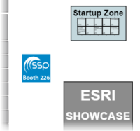
Booth: #226
| We're teaming up with SSP Innovations in booth #226. |
 |
| Day | Time |
| Monday, October 31, 2022 | 9:00 am – 6:00 pm |
| Tuesday, November 1, 2022 | 9:00 am – 6:00 pm |
| Tuesday, November 1st |
| 1:00 PM - Maximizing network deployments (Leveraging GIS to propel growth in telecommunications) |
| From copper to fiber, the progression of telecommunications technology over the last several decades has boosted bandwidth to fuel our increasingly connected lifestyles. In turn, these networks have become more and more complex to manage. With significant investments being made to deploy fiber faster, geospatial awareness has become vital in ensuring companies are maximizing the utilization of their networks. In this session, learn how GIS has been key to propelling network growth. Presenters: Jay Anderson, CTO, FiberLight Andrew Wright, Technical Product Manager, 3-GIS Topic: Planning and Engineering |
Monday night at 7:30 pm, we will be hosting our customer appreciation event for our users, future clients, partners and friends.
Come join us to get to know the SSP & 3-GIS teams and our user-base, while enjoying food and an open bar at the Kimpton Rowan Palm Springs Rooftop.
This event is by invitation only. If you have not received an invitation and are interested in meeting with our community and joining the party, please email events@sspinnovations.com.
Our GIS-based platform serves as the foundation for businesses to plan, design, manage, and expedite the buildout of their fiber networks. Providing real-time data that can be used enterprise-wide, 3-GIS | Network Solutions enables automation for faster service activation, in one seamless system.
| Find out how 3-GIS and ESRI can help transform how your teams make decisions, collaborate, engage, and improve KPIs in this comprehensive webinar. | Discover how 3-GIS | Web takes the complexity out of fiber network management while giving you the framework needed to model your evolving network infrastructure. | Watch this two-minute video to see how 3-GIS | Web and ArcGIS work seamlessly together in an easy-to-use system that expedites every phase of fiber network development. |