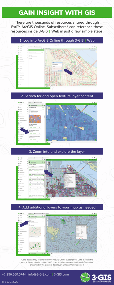
Geographic information systems (GIS) are used widely in telecom for mapping out the network footprint. However, GIS can move far beyond map imagery to provide analytics that give service providers and engineering companies alike the insight they need to make more informed decisions. From empowering buildout strategies to uncovering potential gains in revenue, GIS data will continue to play a pivotal role in the expansion of the global fiber footprint. Review the below infographic to see how you can reference supplemental GIS data inside 3-GIS | Web.